 |
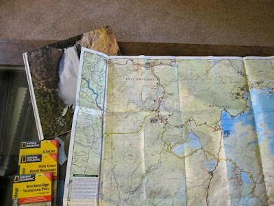
| Jellystone (Yellowstone National Park!!) Notice the photo book I made! |
When we go to national parks, we try to get one or more of this type of map. I like all the pretty colors. Hee Hee. Kidding. The maps are colorful but they help get us oriented to the area. They show elevation so I'll know if I need my parka for the turnaround point on our hike or if I need to take oxygen with me. They can also tolerate getting wet which seems to happen once or twice when we go hiking.
Evil Twin just asked if it shows Yogi and Smokey.
Sheesh.
The other maps in the photo are from Glacier National Park and a couple from Colorado National Forest areas.
Be sure and get lost over at Ziva's today. Oh, and make sure you stop in at MikeWJ's place and have him take you to Mt. Evans. Mind the bear activity nearby.


14 comments:
Very nice. We have to go hiking someday.
I love this everything about this picture. Maps, maps, maps! Whee!
I haven't used a map in many years, since the invention of GPS.
I love to hike! Nothing beats a good map when in the woods. Unlike cell phones, etc. their batteries never run dry.
The light might be a freight train or the first stop on the afterlife express.
I've been to Yellowstone Park. Incredible place, too bad I'm afraid of heights. Wait! Is that part of the Grand Canyon, or am I in the wrong state?
Doing Mount Evans was enough hiking for me! Great take on the prompt, Reffie. :)
@Timothy - Thanks. I'm ready for that hike!
@Cheryl - Thanks. Me, too. I should really look at our collection more often.
@Babs - I like GPS but I love my maps.
@Nora - And these like water much better than the technology!
@Lauren - THE Grand Canyon is in Arizona. Yellowstone National Park has a section called the Grand Canyon of the Yellowstone that includes the waterfalls. Gorgeous!
@Ziva - Thanks. I would be gasping for air on Mt. Evans, too, but I still want to do it!
Mind the bear activity nearby. AND the bare activity. They're both risky.
I work for the National Park Service and find it interesting that you rely on Nat Geo for your maps instead of our fine, free products. We suck.
I love maps!!! We always buy a local map when we go away, too. We have an Italian road map, and one for the USA, and we have full-sized wall maps of both countries too, so we can plot routes etc. I adore them!
Good choice!
I have ways wanted to go there... My bucket list place!
what is a map?? lol
@MikeWJ - We used the NP stuff, too, and it isn't exactly "free" when you have to pay an entrance fee. :)
@Jay - Thanks. It sounds like you love to travel, too.
@Katherine - Hope you get there!
@Janine - LOL
That's an awesome map - too bad I can't read maps to save my life!!
Topographic maps are my favorite. My only complaint about them is they don't show where Yogi lives.
Post a Comment